

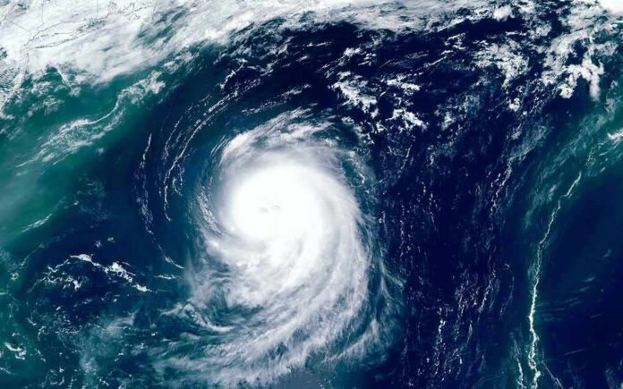
Tropical Storm Bertha has made landfall in Louisiana, and forecasters say the weakening system still poses a rain and wind threat along the Gulf Coast.
Quick Take
- Bertha made landfall Wednesday afternoon in St. Bernard Parish, Louisiana, near the Biloxi Wildlife Management Area.
- The National Hurricane Center estimated maximum sustained winds at 45 miles per hour at landfall.
- Forecasters said tropical-storm conditions could continue across southeastern Louisiana, including the New Orleans metro area.
- Heavy rain, coastal flooding, and gusty winds remained the main concerns as the storm moved west.
Landfall Near New Orleans
The National Hurricane Center said the center of Tropical Storm Bertha made landfall near the Biloxi Wildlife Management Area in St. Bernard Parish, Louisiana, about 40 miles east of New Orleans. The agency estimated maximum sustained winds at 45 miles per hour at landfall and said the storm was moving west-northwest at 7 miles per hour. The storm remained a broad, disorganized system, but it was still strong enough to affect a large stretch of the Gulf Coast.
Earlier advisories had already placed southeastern Louisiana in the storm’s path. The National Hurricane Center said tropical-storm conditions were expected along portions of the northern Gulf Coast from the Florida Panhandle to southeastern Louisiana, including the Metro New Orleans area, through Wednesday night. Local reporting also noted warnings for the New Orleans metro and nearby coastal zones as the storm approached, showing how the forecast shifted from watch mode to landfall mode in a few hours.
What the Storm Is Bringing
Forecasts called for heavy rain, strong gusts, and coastal flooding as Bertha crossed southern Louisiana and later moved toward Texas. The National Hurricane Center said the storm would continue to weaken after landfall, but it could still hold tropical-storm strength into Thursday. AccuWeather and FOX Weather both reported the risk of localized flash flooding, rough surf, and dangerous rip currents along the northern Gulf Coast.
The storm’s shape matters as much as its name. Forecasters described Bertha as messy and lopsided, which often means the worst weather is spread unevenly. That can leave one community with only light impacts while another, just a short drive away, gets stronger rain bands and wind gusts. For families, workers, and local officials, that kind of uncertainty is part of the frustration. The warning is real, but the exact damage often depends on a narrow storm track and timing.
Why the Forecast Matters
Bertha fits a familiar Gulf Coast pattern. Forecasters often face a moving target when storms approach warm water, shallow coastlines, and crowded cities. A research review of Gulf tropical cyclones found that tropical storms and depressions strengthened by about 7 knots per 12 hours on average over longer periods, but showed little net change in the final 12 hours before landfall. That helps explain why late forecast updates can change fast without rewriting the whole threat.
Tropical Storm Bertha is about 40 miles southwest of New Orleans, drifting slowly west at 7 mph. Winds still 45 mph. Warnings stretch from the AL/FL border to Cameron LA, including metro New Orleans. Watch continues west to Sargent TX. Full advisory coming soon. pic.twitter.com/f4Yahh3cPQ
— Glenn Glazer WPBF 25 Meteorologist (@WPBF_Glenn) July 22, 2026
The broader issue is public trust. When a storm warning names a major city, people want a simple answer about whether they are safe or not. The real answer is less tidy. Bertha’s landfall in Louisiana showed that the risk was not a media exaggeration, but it also showed why forecasters avoid sharp claims too early. The storm can weaken, shift, and still leave the region with flooding rain and wind damage long after the center moves on.
Sources:
facebook.com, nhc.noaa.gov, weather.gov, youtube.com