
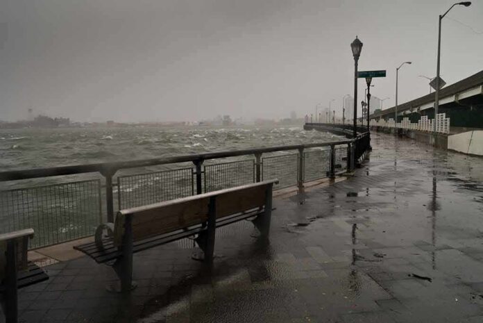
Waves as tall as a five-story building slammed into California’s coast this weekend, forcing officials to shut down beaches from Monterey to the Bay Area.
Story Snapshot
- The National Weather Service issued a High Surf Warning for 25- to 35-foot waves, with some sets reaching 40 to 50 feet.
- A meteorologist said waves at the famous Mavericks surf break hit 50 to 60 feet.
- California transportation officials closed multiple beaches and coastal turnouts across the Monterey Peninsula.
- The warning covered Pacific coast beaches from the San Francisco area down through Big Sur.
Weather Service Sounds the Alarm
The National Weather Service office in San Francisco issued a High Surf Warning on November 14, 2026. The warning called for “dangerously large breaking waves” of 25 to 35 feet, with some sets hitting 40 to 50 feet at favored spots. It covered all Pacific coast beaches in the San Francisco, Coastal North Bay, San Francisco Peninsula, and Monterey Bay areas. The warning stayed active until 4 a.m. the next day.
Forecasters did not just warn about big waves. They spelled out real dangers. High tides could flood low streets, shut down roads, and chew away at the shoreline. The surf itself could pull swimmers and walkers into the ocean, raising the risk of serious injury or drowning. The warning treated the storm as a genuine threat to life, not just a surfing story.
Beaches Shut Down Across Monterey Peninsula
California’s transportation agency, Caltrans, confirmed local governments closed several beaches ahead of the swell. San Carlos Beach, McAbee Beach, Pacific Grove’s coastal turnouts, Pebble Beach, Carmel River State Beach, Garrapata Beach, Point Lobos State Natural Reserve, and Asilomar State Beach all closed from Friday evening through Sunday morning. Officials said the closures could stretch longer if conditions stayed dangerous.
Caltrans pointed to a west and northwest swell as the driving force behind the danger. The agency said the roughest conditions were expected to hit Saturday, matching other reports that breaking waves could reach 35 feet at the peak. Closing beaches ahead of time let agencies act before the worst waves arrived, rather than reacting after people were already in harm’s way.
Numbers Matched Up at Multiple Beaches
Independent reporting backed up the scale of the swell. Waves topped 30 feet at Monterey and Point Reyes. San Francisco and Half Moon Bay saw waves over 20 feet. At favored breakpoints like Mavericks, waves reached as high as 50 feet, according to the Spokesman-Review.
Rachel Kennedy, a meteorologist with the National Weather Service Bay Area, said most of the coast saw waves over 25 feet. But she said Mavericks, a surf break known for massive swells, saw far bigger waves. “More localized” waves there reached 50 to 60 feet, she said. Her comment matched the warning’s point that some spots would see much bigger waves than the general coastline.
The Pacific Ocean surges across a beachfront road and into a café as people continue eating and drinking. California is being battered by extreme surf and coastal flooding as one of the most powerful El Niño events on record intensifies. pic.twitter.com/Ui9fok7Ekf
— Kerry Holmes (@KerryHolmekb) November 15, 2026
This event fits a pattern seen along the California coast for years. High-surf warnings get issued based on forecast conditions and potential danger, not on whether damage or injuries actually happen. The National Weather Service treats a warning as justified once breaking waves create a serious threat in the surf zone, regardless of the final outcome. That is why agencies moved to close beaches before anyone got hurt, acting on the forecast rather than waiting to see what happened.
For longtime coastal residents, this kind of storm is nothing new, but the numbers this time stood out. Whether the cause tied back to a passing storm system, high tides, or longer-term coastal changes, the practical result was the same: closed beaches, flooded roads, and a clear warning to stay out of the water until conditions eased.
Sources:
nytimes.com, forecast.weather.gov, usairnet.com, dot.ca.gov