

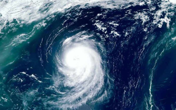
Hurricane Polo blew up from a weak tropical storm into a Category 5 monster in less than 24 hours, and Mexican President Claudia Sheinbaum is telling coastal residents to stay alert even though the storm is not expected to make direct landfall.
Story Snapshot
- Hurricane Polo reached Category 5 strength with sustained winds near 165 mph off Mexico’s Pacific coast.
- The storm intensified from a tropical storm to Category 5 in roughly a day, one of the fastest jumps on record.
- Polo is expected to stay offshore, but Mexico issued tropical storm warnings and watches along the Guerrero and Michoacán coasts.
- President Claudia Sheinbaum urged vigilance as heavy rain and flooding remain the main threats to Mexican communities.
Storm Reaches Rare Category 5 Strength
The National Hurricane Center declared Polo a Category 5 hurricane on the Saffir-Simpson scale in an advisory issued Tuesday, September 22, 2026. The bulletin described the storm as stationary off the coast of southwestern Mexico, with maximum sustained winds near 165 mph and higher gusts. That intensity puts Polo in the same class as the most destructive storms measured anywhere on Earth.
Reports from multiple outlets tracked wind speeds ranging from 160 mph to 180 mph depending on the exact hour of measurement, a normal pattern for a storm updated every few hours by aircraft and satellite data. The New York Times reported Polo went from a weak tropical storm to a Category 5 in less than a single day, while EarthSky said the shift from tropical storm to Category 5 happened between September 21 and the morning of September 22.
Warnings Line Mexico’s Pacific Coast
The hurricane center placed a tropical storm warning along the coast from Tecpan de Galeana to Punta San Telmo, with a tropical storm watch extending farther west toward Playa Perula. Forecasters expect Polo to skirt the shoreline for several days without making a direct landfall, according to coverage from ABC30, though the storm’s size means its effects reach far inland even while its center stays over open water.
Rain, not wind, poses the biggest danger to people on land. The hurricane center’s advisories point to heavy coastal rainfall as the primary hazard for Guerrero and Michoacán, raising the risk of flash floods and mudslides in mountainous terrain. That distinction matters because a Category 5 label often conjures images of a direct hit, when the real threat here comes from water dumped along a coastline the storm never actually crosses.
Sheinbaum Calls for Caution Along Coast
President Sheinbaum urged residents in the storm’s path to stay alert and follow official guidance as Polo churns offshore. Her message reflects a broader pattern in hurricane response: officials must balance warning the public about a historic storm with clarifying that the worst outcome, a direct landfall, is not the current forecast. Local authorities in coastal states are expected to keep monitoring the storm’s track in case conditions shift.
Why the Storm Grew So Fast
Meteorologists call Polo’s jump in strength “rapid intensification,” defined as a wind speed increase of at least 35 mph within 24 hours. Weather.com reported Polo met and exceeded that threshold as it exploded into a Category 5. Climate researchers have documented this pattern becoming more common in major hurricanes worldwide, tied to warmer ocean water that gives storms more fuel to strengthen quickly before landfall.
Hurricane Polo rapidly intensifies to Category 5 with 180 mph winds as Mexico watches closely | LINK IN BIO pic.twitter.com/YU4yOo5hSR
— wdsu (@wdsu) September 23, 2026
About 80% of major hurricanes now undergo some form of rapid intensification before reaching their peak strength, according to climate researchers who track storm data across multiple ocean basins. That trend makes storms like Polo harder to forecast days in advance and gives coastal communities less time to prepare, even when the storm’s center stays offshore rather than crossing land directly.
Sources:
youtube.com, accuweather.com, riotimesonline.com, nhc.noaa.gov, aoml.noaa.gov